 BarcelonaWalking Barcelona Hiking Barcelona Montserrat Costa Brava Pyrenees
THE TOUR OF MONT BLANC.
THE TOUR OF MONT BLANC. is the most impressive trekking in Europe.
The Complete circuit begins and ends in Chamonix.
Hiking with a guide and mule carrying the weight of your equipment.
It is a full tour passing through France, Italy and Switzerland.
Enjoy the highest comfort and the mountaineering history.
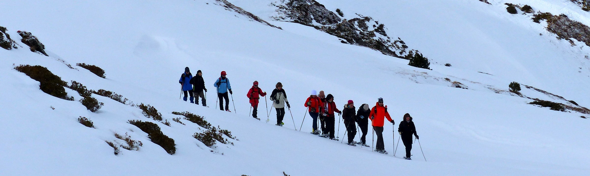
Around Mont Blanc is a complete tour for hiking. Within ten days you will walk the most scenic trails of the Alps. You will have time to enjoy every corner where historical scenes of alpinism occurred. This tour around Mont Blanc is challenging for avid mountain hikers. The luggage will be carried by vehicle during the first days and then by mule.
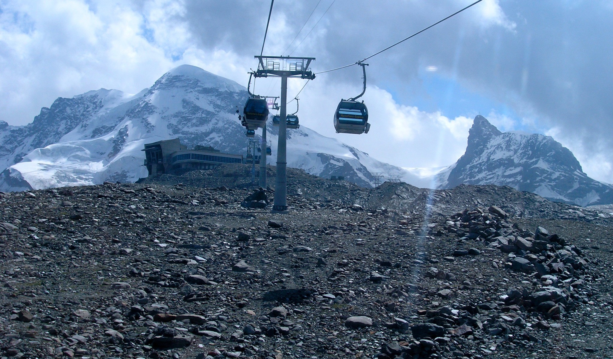
The tour of the Mont Blanc goes through valleys and hills. It is a pleasure to behold. In addition, you will feel the satisfaction of making a journey between well known mountains of the Alps. The peaks such as Mont Blanc, Mount Maudit, Les Jorases, Aiguille Verte, and glaciers such as Grand Montets, Bossons and the Mer de Glace, where pillars and walls converge, are like few places in the world. Spread across three countries, Italy, Switzerland and France, the Massif offers a different environment in each of these countries.
DAY 1: CHAMONIX.
It doesn’t matter if you come by plane or car, we will be waiting for you in Chamonix. The Group will meet their guide for a briefing at 6 pm at a reception in the Hotel Les Grands Montets in Chamonix ****
DAY 2: Chamonix – Les Houches 1,007 m. – CHALET DU TRUC
We start by going in our support vehicle to Les Houches. The walk starts in the car park. The tour around the Mont Blanc begins nearby, at the cable car of Bellevue Road, passing first through the col of Voza at 1.635m of elevation, continuing up to the col Tricot at 2.120m. From here it takes one hour to get down to Chalets de Miage, and in another half hour climb you will arrive at the Chalets du Truc at 1.720m.
Totals of the day: Elevation gain 1,720 m. Hiking time 5.45h.
DAY 3: CHALET DU TRUC 1.720m. – VILLA BALME.
This day is slightly shorter than the previous day. The path starts descending towards Les Contamines but bypasses it staying to the right. We continue along the Combe d’Armancette, pass the uninhabited houses of La Frasse, and continue ascending. After a while you will pass a beautiful fountain. The path continues to the hotel Tré la Tete, at 1.970m elevation. From this point it begins to descend to Nant Barrant 1600m and ends with a short climb to the Chalet de Balme.
Totals of the day: Elevation gain 1.706m. Hiking time 5.30h.
DAY 4: VILLA BALME. 1.706m. – REFUGE DES Mottets
The fourth day of trekking begins with a fairly steep climb then gets easier. You will pass the Plan des Dames at 2.040m. From there the path continues along a slope towards the col de Bonhomme at 2.329m. It is really a challenging path. Then another path rises towards the col des Fours located at 2.665m and continues through the Croix de Bonhomme at 2.433m. From here you can climb to the top in half an hour if the weather conditions and the group fitness allows. Then we go down to the Ville des Glaciers at 1.789m and finally after a short climb you will reach the refuge des Mottets.
Totals of the day: Elevation gain: 1.870m. Hiking time 6.00h.
DAY 5: REFUGE DES Mottets 1.870m.- COL Chécrouit
The hiking starts with zigzags, taking approximately 1.45h to reach the col de la Seigne at a height of 2.516m. It is a mountain on the border between France and Italy. Then we will pass the Elisabetta refuge as we go down at 2,200m. Then nearby we pass the lake Combal at 1.970m. After a rest you will climb back up to the edge of Fauvre at 2,400m. Finally the path follows a hillside which leads to the col de Checrouit and end of the stage.
Totals of the day: Ascent: 1916m. Hiking time 6.20 h.
DAY 6: COL Chécrouit 1916m.-SHELTER BONATTI
On this day we will start hiking down to the pretty village of Courmayeur at 1.226m where we can shop with some suppliers. Then you will continue climbing to the refuge Bertone at 1.991m. Next you continue through the Mon de la Saxse at 2.349m and the Testa Bernarda at 2.534m. This is the end of the first climb of the day. From here you will go down and past the col Sapin at 2.436m and follow to Alpe di Secheron at 2.260m. Then after a short climb we reached the Pas Deux Sauts at 2.524m. Continuing on, the path will take you one hour, going down, to arrive at the Bonatti shelter, dedicated to renowned alpinist Walter Bonatti.
Totals of the day: Elevation gain: 2.056m.Tiempo hiking 7.15h.
DAY 7: SHELTER BONATTI 2.056m. – G. LES GLACIERS (La Fouly)
From the Shelter, you climb a few meters and then you will go down half an hour to pass through the Vachey at 1.642m. Here it begins to climb to the refuge Elena at 2.062m. From this shelter the climb continues to the Grand col Ferret located 2.537m where we left Italy and entered Switzerland. From here the path drops about 3 hours. You will pass a farm zone with shops of Swiss products and finally arrive at La Fouly.
Totals of the day: Hiking Time: 5.30 h.
DAY 8: G. LES GLACIERS (La Fouly) – SHELTER Arpette
Today will be easier. You will start going down gently on the left side of the valley to the beautiful village of Praz de Fort at 1.151m. Later you will continue going down to Isert, and then rise slowly to Champex at 1.477m. From Champex, continue on a short but somewhat steeper climb to the refuge of Arpette.
Totals of the day: Elevation gain: 1.642m. Hiking time 4.00 h.
DAY 9: SHELTER Arpette 1.642m.- CHALET LA FORCLAZ
At this stage, we pass first the cabana Arpette, the highest point for our return. It goes up to the col de Arpette at 2.665m of elevation, taking about three hours. From this col there is a sharp drop and in two hours you will arrive at the Chalet du Glacier at 1.583m where you continue on a gentle hillside until the col de la Forclaz.
Totals of the day: Elevation gain: 1.526m. Hiking time 6.15h.
DAY 10: VILLA LA FORCLAZ 1.526m. – LA BOERNNE
Today’s stage starts heading toward the Chalet du Glacier 1.583m. After about 45 minutes you will take the Arpette variant, where you cross a stream and begin the climb to Les Grans, reach the col de Balme, after a place equipped with a handrail. The col de Balme at 2.191m is the border between Switzerland and France. Then you continue down to the col de Postes at 1.997m and climb the needle of the same name at 2.201m. From here we will begin a steep descent of one hour and a half, Tre le Champ up to 1.497m, to Gite de la Boernne.
Totals of the day: Elevation gain: 1.415m. Hiking time 5.15 h.
DAY 11: THE BOERNNE 1.415m. – Les Houches 1.007M. – Chamonix.
This is the last day of the trekking and certainly the longest. It starts up in a southwesterly direction towards the Argentier needle at 1.893m. You will climb a chimney, by a metal ladder and then a shorter stairway with a very safe handrail to 2130m of elevation. You will continue toward lakes and later on to Chéseryes White lake at 2.352m. The view is spectacular and shows the full extent of the entire trek. Now you will continue down to the Chalet de la Flegere at 1.877m. Then you will continue climbing, going to Planpraz at 2,000m. Later you continue to Col Brevent at 2.368m with a continuous climb to Le Brevent 2.525m. Then down for three hours. You will walk through the Self Merlet and Les Houches christ Roy at 960m and arrive at the Hotel Les Grands Montets **** and the end of the tour, where we can all expect a nice break.
Totals of the day: Hiking Time: 8.00 h.
DAY 12: Chamonix. Departure day
We will organize for you the transfer to Geneva airport and from there to the different points of origin.
IMPORTANT NOTE
EL tour described in this itinerary may be altered at the discretion of the guide due to the conditions of the mountain and the safety of the group.
RECOMMENDATIONS
The efforts made in this tour is difficult. Average daily time for hikes is between 5-7hours. The elevation changes may occasionally reach 1,000m. It is important that you consider the fitness level required to participate in the Tour du Mont Blanc. If it does not suit your fitness and technical levels, it may frustrate you.
This program may be altered at the discretion of the guide, based on weather conditions, physical and technical conditions of the participants or for any unforeseen event that may be detrimental to the safety of the group. Any extra expense of accommodation, food, transport and others as a result of this alteration is borne by the participants.
Equipment needed:
PASSPORT, Backpack, sleeping bag, comfortable trekking boots (not new ones), crampons, canes, 2 shirts, Fleece Jacket blizzard, Tracksuit, long and short pants, 2 pairs of socks, thin gloves, 1 mountain hat, 1 sun hat, rain coat, Sunscreen, lip Protection, Razor, Canteen, sunglasses, small flashlight, Spontex or small towel, ear plugs are advised, two large plastic bags (in case of rain, backup clothing)
Additional recommendations.
Choose the route considering meteorological conditions, path conditions, your physical capabilities, the equipment , and the time that you have. We will inform you of the itinerary. Please do not go alone; caution is always required. Check the condition of the path; these can be modified based on weather conditions and seasons. Do not leave the path; respect private property. Dogs are not allowed. Do not disturb wild animals. Leave nature untouched; pack out the waste. In Italy, at 2,500 m of elevation, bivouac and camping is forbidden outside the areas provided for this purpose. You are responsible for your safety. In case of accident call 112 in France, 118 in Italy and 144 in Switzerland.
SOME VIEWS ON THIS ROUTE
The Tour of Mont Blanc is a hike that is exciting. I have contracted this guided tour to Making Track Travel and it has been an unforgettable experience. These guides are familiar with the Alps and they share adventures of the classic mountaineering history. The guide will share historical experiences of the climbers who conquered these mountains. Mont Blanc with its glaciers is spectacular. In short, it’s a highly recommended route.